Our planet is constantly sending signals about its environmental health, and thanks to cutting-edge satellite technology, we’re finally learning to read them with unprecedented clarity and precision.
For decades, scientists struggled to piece together a comprehensive picture of global pollution patterns, relying on scattered ground-based monitoring stations and limited aerial surveys. Today, a constellation of sophisticated satellites orbits Earth, continuously tracking emissions, detecting pollutants, and providing real-time data that’s transforming how we understand and combat environmental degradation. This revolution in monitoring capabilities is not just advancing scientific knowledge—it’s empowering governments, organizations, and citizens to take targeted action against one of humanity’s greatest challenges.
🛰️ The Evolution of Space-Based Environmental Surveillance
The journey of satellite-based pollution monitoring began in the 1970s with rudimentary sensors capable of detecting basic atmospheric changes. Early satellites like Landsat provided valuable land-use imagery but offered limited insight into air quality or specific pollutants. The real breakthrough came in the late 1990s and early 2000s when specialized instruments designed specifically for atmospheric chemistry began launching into orbit.
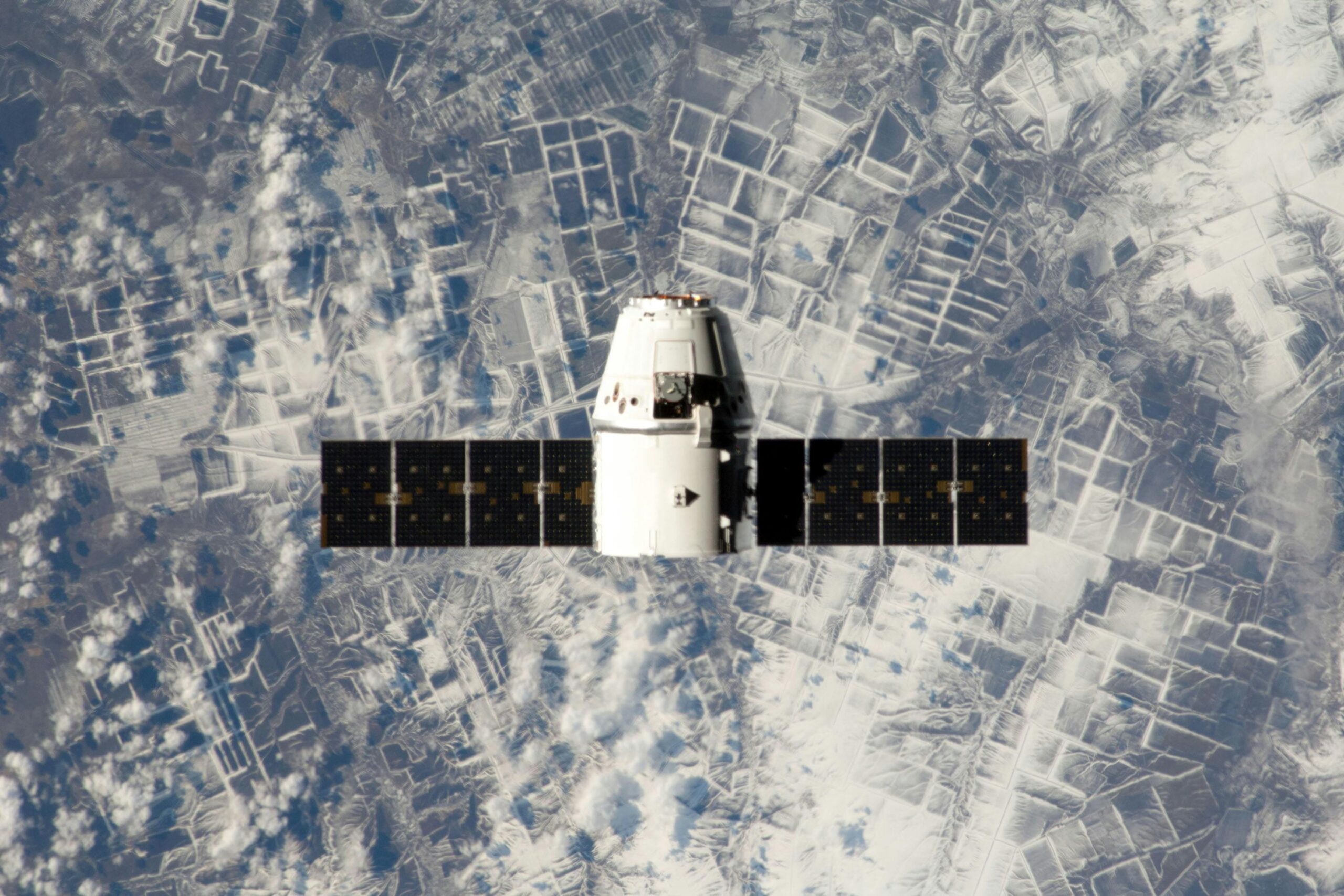
Modern environmental satellites represent a quantum leap forward. Equipped with hyperspectral sensors, infrared detectors, and advanced imaging technology, these orbital platforms can identify specific chemical signatures from hundreds of kilometers above Earth’s surface. They measure everything from nitrogen dioxide concentrations over urban areas to methane leaks from industrial facilities, and from particulate matter distribution to ozone layer variations.
The European Space Agency’s Sentinel-5P satellite, launched in 2017, exemplifies this new generation of environmental guardians. Its TROPOMI instrument can detect air pollutants with unprecedented resolution, creating detailed maps of global air quality that would have been unimaginable just two decades ago. NASA’s OCO-2 satellite, meanwhile, specializes in carbon dioxide monitoring, providing crucial data for understanding climate change dynamics.
Decoding the Invisible: What Satellites Can Actually Detect
The sophistication of modern satellite sensors allows them to identify and quantify numerous pollutants that are invisible to the naked eye. Nitrogen dioxide (NO₂), a harmful gas produced primarily by vehicle emissions and power plants, appears as distinct spectral signatures that satellites can measure across entire continents. This capability has revealed startling patterns, such as the dramatic pollution reductions during COVID-19 lockdowns and the persistent smog blankets over rapidly industrializing regions.
Methane detection represents another frontier where satellite technology excels. This potent greenhouse gas, often leaked from natural gas infrastructure and agricultural operations, is notoriously difficult to track from the ground. Satellites equipped with shortwave infrared sensors can now pinpoint individual methane plumes, sometimes tracing them to specific facilities or pipelines. This has led to accountability measures and remediation efforts that would have been impossible with ground-based monitoring alone.
The Pollution Dashboard in Space 📊
Different satellite systems specialize in monitoring specific environmental parameters:
- Aerosol Optical Depth (AOD): Measures particulate matter suspended in the atmosphere, indicating air quality and visibility
- Sulfur Dioxide (SO₂): Tracks volcanic emissions and industrial pollution from coal-burning facilities
- Carbon Monoxide (CO): Monitors incomplete combustion from vehicles, wildfires, and industrial processes
- Ozone (O₃): Measures both stratospheric ozone layer health and ground-level pollution
- Formaldehyde (HCHO): Indicates volatile organic compound emissions from vegetation and industrial sources
From Raw Data to Actionable Intelligence
Collecting pollution data from space is only half the battle. The real value emerges when this information transforms into actionable intelligence that drives policy decisions and environmental interventions. Advanced algorithms and machine learning models process the massive data streams from satellites, identifying trends, anomalies, and pollution hotspots that demand attention.
International organizations like the World Health Organization and United Nations Environment Programme now incorporate satellite data into their environmental assessments and policy recommendations. Cities worldwide use this information to implement targeted air quality improvement measures, such as traffic restrictions during high-pollution episodes or strategic placement of green infrastructure.
The democratization of satellite data has been particularly significant. Platforms like NASA’s Earthdata portal and ESA’s Copernicus program provide free access to pollution monitoring data, enabling researchers, journalists, and advocacy groups to conduct independent analyses. This transparency has empowered communities to hold polluters accountable and advocate for cleaner environments with evidence-based arguments.
🌍 Global Success Stories: Satellites Driving Change
Real-world applications of satellite pollution monitoring demonstrate its transformative potential. In China, satellite data documenting severe air pollution contributed to the government’s aggressive clean air campaign launched in 2013. The “war on pollution” implemented stricter emission standards, phased out coal-fired plants, and promoted renewable energy. Satellite measurements confirmed significant improvements, with nitrogen dioxide levels dropping by 20-40% in major cities over subsequent years.
The European Union leveraged satellite data to enforce its Industrial Emissions Directive more effectively. By cross-referencing reported emissions with satellite observations, regulators identified facilities exceeding permitted pollution levels. This satellite-based compliance monitoring proved more cost-effective than traditional ground inspections while providing comprehensive coverage across member states.
Catching Environmental Criminals Red-Handed
Satellites have become powerful tools for detecting illegal environmental activities. Unauthorized crop burning, a major source of particulate pollution in regions like South Asia, is now routinely identified through thermal imaging and smoke plume detection. Similarly, illegal industrial discharge and unreported emissions from ships at sea no longer escape detection thanks to persistent satellite surveillance.
In 2020, satellite data helped identify a massive sulfur dioxide release from a copper smelter in Russia that the facility had not reported. The detection led to investigations, fines, and mandated emission control upgrades. Such examples demonstrate how space-based monitoring creates accountability even in remote or poorly regulated areas.
The Technology Behind the Magic: How Satellites See Pollution
Understanding how satellites actually detect pollution reveals the sophisticated science enabling this monitoring revolution. Most environmental satellites use spectrometry, which analyzes how different wavelengths of light interact with atmospheric molecules. Each pollutant absorbs and reflects specific wavelengths, creating unique spectral fingerprints that instruments can identify.
When sunlight passes through the atmosphere, pollutant molecules absorb certain wavelengths while allowing others to pass through or reflect back toward space. Satellite sensors measure this altered light spectrum and compare it to baseline measurements, calculating pollutant concentrations through complex algorithms. The precision of modern spectrometers allows detection of pollution at parts-per-billion concentrations from orbital altitudes.
Thermal infrared sensors operate differently, detecting heat signatures that indicate industrial activity, fires, or methane releases. These instruments essentially “see” heat, enabling nighttime monitoring and detection of pollution sources that might be invisible in standard optical imagery. Synthetic aperture radar provides yet another capability, penetrating clouds and darkness to monitor environmental changes regardless of weather conditions.
🔬 Integration with Ground-Based Networks: The Hybrid Approach
While satellite technology has revolutionized pollution monitoring, it works best when integrated with traditional ground-based measurement networks. Surface monitors provide highly accurate localized measurements and can detect pollutants that satellites struggle to observe, such as certain particulate matter compositions. The combination creates a comprehensive monitoring ecosystem with complementary strengths.
Validation of satellite measurements against ground truth remains essential for maintaining data accuracy. Calibration campaigns regularly compare satellite readings with high-precision ground instruments, adjusting algorithms to account for atmospheric interference, sensor drift, and other variables. This continuous calibration ensures that satellite data meets scientific standards for policy and research applications.
The synergy between space-based and ground-based monitoring enables sophisticated air quality forecasting. Meteorological models incorporate satellite pollution data along with weather patterns and emission inventories to predict air quality days in advance. Cities use these forecasts to issue health advisories, adjust traffic patterns, and implement temporary emission restrictions before pollution episodes intensify.
Emerging Technologies: The Next Frontier
The satellite pollution monitoring field continues evolving rapidly with several exciting developments on the horizon. Geostationary satellites, which remain fixed over specific Earth regions rather than orbiting, promise continuous real-time monitoring of pollution dynamics. NASA’s TEMPO mission and ESA’s Sentinel-4 will provide hourly pollution updates over North America and Europe respectively, capturing diurnal variations and sudden emission events that polar-orbiting satellites might miss.
Miniaturization technology is democratizing access to space-based monitoring. CubeSats—small, low-cost satellites—are being deployed in constellations that provide frequent revisit times and targeted monitoring of specific regions or pollutants. These agile platforms can be developed and launched more quickly than traditional large satellites, enabling rapid response to emerging environmental challenges.
Artificial Intelligence Amplifying Satellite Capabilities 🤖
Machine learning algorithms are dramatically enhancing what we can extract from satellite data. AI models trained on years of pollution observations can now identify subtle patterns indicating emission sources, predict pollution dispersion under various conditions, and even forecast future trends based on economic and meteorological inputs. These capabilities transform satellites from passive observers to active components of environmental management systems.
Deep learning techniques can process satellite imagery orders of magnitude faster than human analysts, enabling near-real-time pollution mapping and alert systems. Computer vision algorithms automatically identify industrial facilities, traffic patterns, and land-use changes that contribute to pollution, creating comprehensive emission inventories without labor-intensive ground surveys.
Challenges and Limitations: The Realistic Picture
Despite remarkable capabilities, satellite pollution monitoring faces significant challenges. Cloud cover remains a persistent obstacle for optical and infrared sensors, creating data gaps in chronically cloudy regions. While radar can penetrate clouds, it cannot measure most atmospheric pollutants, limiting all-weather monitoring options.
Spatial resolution, though constantly improving, still limits satellite capability to detect small pollution sources or distinguish between nearby emission points. A satellite that can identify a large industrial plume might miss emissions from individual vehicles or small facilities. Temporal resolution also poses challenges—most environmental satellites revisit the same location every few days, potentially missing short-duration pollution events.
Data processing and distribution infrastructure struggles to keep pace with the massive volume of information satellites generate. A single day of measurements from instruments like TROPOMI produces hundreds of gigabytes of data requiring specialized expertise to process and interpret. Making this information accessible and understandable for non-specialists remains an ongoing challenge.
🌐 Global Cooperation and Data Sharing
The transboundary nature of air pollution makes international cooperation essential for effective monitoring and mitigation. Pollutants released in one country frequently affect air quality in neighboring nations, making satellite monitoring a crucial tool for diplomatic engagement on environmental issues. Several international frameworks now incorporate satellite data as objective evidence for cross-border pollution discussions.
The Committee on Earth Observation Satellites coordinates data sharing among space agencies worldwide, ensuring complementary missions and open data access. This collaboration maximizes the value of each satellite investment while avoiding redundant capabilities. Developing nations benefit particularly from this data sharing, gaining access to sophisticated monitoring capabilities they could not afford to develop independently.
Climate agreements like the Paris Accord increasingly rely on satellite verification of emission reductions. As countries commit to pollution reduction targets, independent satellite monitoring provides transparent verification mechanisms that build trust and accountability. This satellite-based transparency may prove crucial for enforcing future environmental agreements.
Empowering Citizens Through Accessible Data
The true revolution in satellite pollution monitoring extends beyond scientific and policy circles to empower ordinary citizens with environmental awareness. Mobile applications now provide personalized air quality information derived from satellite data, helping individuals make informed decisions about outdoor activities, travel routes, and health precautions.
Environmental advocacy groups leverage publicly available satellite data to document pollution patterns, pressure governments for action, and hold corporations accountable. Investigative journalists use satellite evidence to expose environmental violations that might otherwise remain hidden. This democratization of environmental intelligence represents a fundamental shift in the power dynamics of pollution management.
Educational initiatives are teaching students worldwide to access and interpret satellite data, cultivating a generation of environmentally literate citizens who understand their planet’s health through direct observation rather than abstract statistics. This grassroots engagement with space-based monitoring may ultimately drive the most significant behavioral and policy changes.
🚀 The Road Ahead: Future Possibilities
Looking forward, the integration of satellite pollution monitoring with other emerging technologies promises even more transformative capabilities. The Internet of Things could create seamless networks where ground sensors, satellites, drones, and personal devices share data in real-time, creating comprehensive environmental intelligence systems. Blockchain technology might enable secure, transparent tracking of emissions credits and compliance records verified by satellite observations.
Commercial applications of pollution monitoring data are emerging as businesses recognize the value of environmental intelligence. Supply chain managers use satellite air quality data to assess risks to operations and worker health. Real estate developers incorporate pollution exposure information into planning decisions. Insurance companies adjust premiums based on environmental risk profiles derived from satellite observations.
As climate change intensifies, the role of satellite pollution monitoring will only grow more critical. These orbital sentinels provide essential data for understanding how pollution contributes to climate change, how climate change affects pollution patterns, and how mitigation efforts are performing. The ability to track Earth’s pulse from space may ultimately determine our success in preserving a habitable planet for future generations.
Turning Data Into Action: The Path Forward
The revolution in satellite pollution monitoring has provided humanity with unprecedented environmental awareness, but awareness alone cannot solve pollution challenges. The critical next step involves systematically translating satellite data into concrete actions—stronger regulations, cleaner technologies, modified behaviors, and innovative solutions.
Success requires continued investment in satellite technology, data infrastructure, and the human expertise needed to transform raw measurements into meaningful insights. It demands political will to act on uncomfortable truths that satellite data reveals. Most importantly, it requires collective commitment to environmental stewardship informed by the objective evidence these orbital platforms provide.
Satellite technology has given us the tools to track Earth’s pulse with remarkable precision, revealing the health impacts of our industrial civilization in vivid detail. The question now is whether we possess the wisdom and determination to act on this knowledge, using these powerful monitoring capabilities not just to document environmental degradation but to prevent it. The satellites are watching, the data is flowing, and the planet’s vital signs are clear—the rest is up to us.